

PFAS contamination is a growing concern for communities across Michigan, affecting lakes, streams, and aquatic life.
A new interactive map has been launched to provide crucial information on contamination levels in the state’s waters, helping residents determine where fish are safe to eat.
Tony Spaniola, co-chair of the Great Lakes PFAS Action Network, explained, “The interactive mapping tool allows fishermen around the state to take a look at whatever stream, lake, or water body that they’re looking to fish in and to see if there are PFAS fish advisories in that particular water body.”
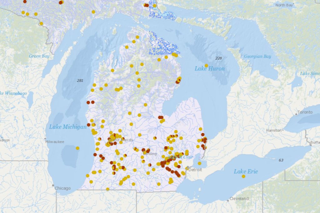
Michigan, home to more than 11,000 bodies of water, has already conducted extensive testing.
“They’ve tested 600, and of the 600, 200 of those water bodies have PFAS consumption advisories,” Spaniola said. “So that’s one out of every three, which is a pretty high number.”
The guideline for safe fish consumption regarding PFAS has decreased from 300 parts per billion to 50 parts per billion, significantly impacting which fish are deemed safe to eat.
Spaniola noted, “Prior to the change in the guidance, there were 33 water bodies in the state that had do not eat fish advisories; now there are 102.”
The map provides detailed information about each water body, with red dots indicating fish are not safe to eat and yellow dots signifying a consumption advisory.
Spaniola added, “It will tell you the water body and the specific species that are covered. And in the case of just a consumption advisory, it’ll tell you so many servings of this type of fish per month or per year.”
This data, sourced from the Department of Health and Human Services, is updated in the spring.
Spaniola emphasized the importance of this information, particularly for children.
“When it comes to your health and the health of your children, I want to really emphasize that PFAS has a very, very disproportionate impact among young children because they do not have a fully developed immune system,” he said.